(Original World Map Picture Link:
http://reference.aol.com/atlas)
Here is our plan for YOU!
We will be moving northwest to land on your first stop...
PALMYRA, SYRIA Palmyra, Syria is like the heart of the Syrian Desert. People often mention it as "the bride of the desert". Palmyra became known as the city of palm trees after the Romans came and conquered this land. Emperor Adrian came to Palmyra and freed the city and the people. So, the people there called their city: Adrianapalmyra. When Emperor Caracalla made it a Roman colony, they constructed streets, arches, temples, statues and other buildings. It soon began to make Palmyra one of Roman empire's greatest cities.
Here, you can take a view that may bring you back to the past...
Latitude: 34°32'53.80"N
Longitude: 38°17'2.73"E
LINKAgain, to your second stop, we will be moving northwest more!
THE ROMANTIC ROAD, GERMANY
(Picture
LINK)
The Romantic Road will travel through different places. It will lead you to wonderful scenic landscapes. Farms, fields, and restaurants serve people with cuisine. There will be a huge section where you can find food to eat. There will be some pizza and ITalian food in that area too...!!
Latitude: 49°47'26.86"N
Longitude: 9°51'50.42"E
LINKTo your third stop, let's go northwest even more, to land!!
SVARTIFOSS, ICELAND
(Picture
LINK)
Scartifoss, also known as the "Black Fall". It's in Iceland's skaftafell National Park. It appeared to be one of the most popular sights of this park. Notice the black layers of rock beside the waterfall? That's dark lava columns (cooled from times). This is why it got it's name (Black Fall). At the base of the waterfall, there will be sharp rocks. The contrast of back and white really stood out. The sheets of dark lava amused many tourists... Maybe you would be amazed too!
Latitude: 64° 1'53.00"N
Longitude: 16°58'21.00"W
LINK
Zoom! We'll go southwest to our fourth destination...
WAIKIKI BEACH, OAHU
(Picture
LINK)
From the top of the Diamond Head, you'll see a beach... The Waikiki Beach. The climate there are usually warm and cloud-free. Many tourists surf there and played with in the sea water.
It is beautiful beach to relax on. If you know how to surf, you 'd probably enjoy it!!
Latitude: 21°16'36.69"N
Longitude:157°49'50.27"W
LINK
Southeast will be our next direction tp the fifth stop...
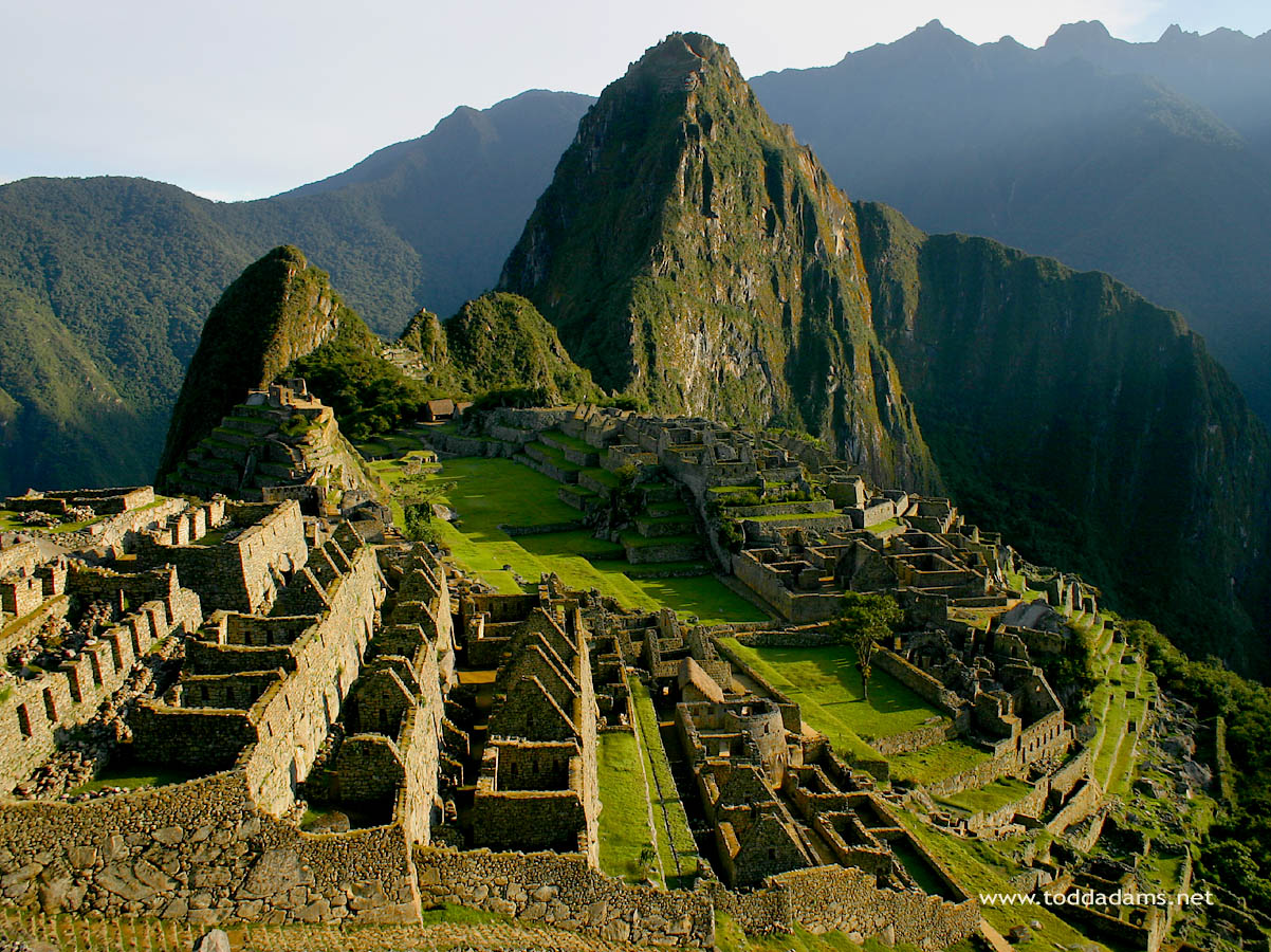
MACHU PICCHU, PERU
(Picture
LINK)
The constructions of Machu Picchu was built around 1460 AD. Machu Picchu has always stand out to be an important tourist attraction. There, as you can see in the picture, are ruins that are left. You may find yourself getting into this place and wanting to explore more of its history...
Latitude: 13° 9'46.26"S
Longitude: 72°30'56.96"W
LINK(A little bit of info. there)
After visiting machu picchu, let's go down a south~~
TORRES DEL PAINE NATIONAL PARK, CHILE
(Picture
LINK)
Torres del Paine National Park is located in the Chilean Patagonia. It was known as one of the most beautiful and unruined place on the planet. You will be able to sea mountain ranges, lakes, flowers, and animals that will make you wanting to stay more. You can hike this park through the hiking trails. You can also camp there at their campgrounds. Try the fun activities there! Try and let yourself go off your limits!!

You can do some climbing, kayaking, rafting, or glacier corssing. After this trip to Torres del Paine National Park, I'm sure it'll stay in your memories forever...
Latitude: 51° 0'0.00"S
Longitude: 73° 0'0.00"W
LINKWe are down to the seventh stop...
Let's go a east this time!
GOURITZ RIVER, SOUTH AFRICA
(Picture
LINK)
Remember what I said about pushing your limits??? Well, this is the best part!!! BUNGI JUMPING!!! Let's go to the most X-tremes!!! Where is it? It's at the Gouritz River Bridge. This bridge is 65 meters high and it seems like, it's the highest bungi site in Africa!! Give it a SHOT!
You would be flying, but without wings. All you need to do is leap, fall, jump, or dive from a platform. You will, of course, be checked to see if you're securely attached properly to the opposite bridge.
It depends on you if you wanna try, or just enjoy watching~~
Latitude: 34°11'11.51"S
Longitude: 21°45'8.07"E
LINK
Then slightly straight east to the eighth stop...
DEVILS MARBLES CONSEVATION RESERVE, AUSTRALIA
(Picture
LINK)
These stones above are made out of granite. These giant stones was thought to have an age of 1.7 billion years. People think that it was the hardening of magma within the crust of the earth. Thick layers of sandston put a lot of pressure on the stones. The pressure will cause the granite to expand, cracks, and or break apart... The roundness of the stones seemed like they've been shapped by mechanical weathering. It's really interesting about these stones... Maybe you caould be the first one to find a mysterial story behind it!!
Latitude: 20°34'0.00"S
Longitude: 134°16'0.00"E
LINKSo! The trip is about like that! You'll find yourself in a tired situation... But thanks goodness! You'll be heading home! Taiwan, let's fly to it!!!!